Geointelligence
The problems we solve
For more than a quarter of a century, MDA has been observing our world from space, using advanced satellite imagery and data analytics to deliver critically important insights into some of the most pressing problems on Earth.
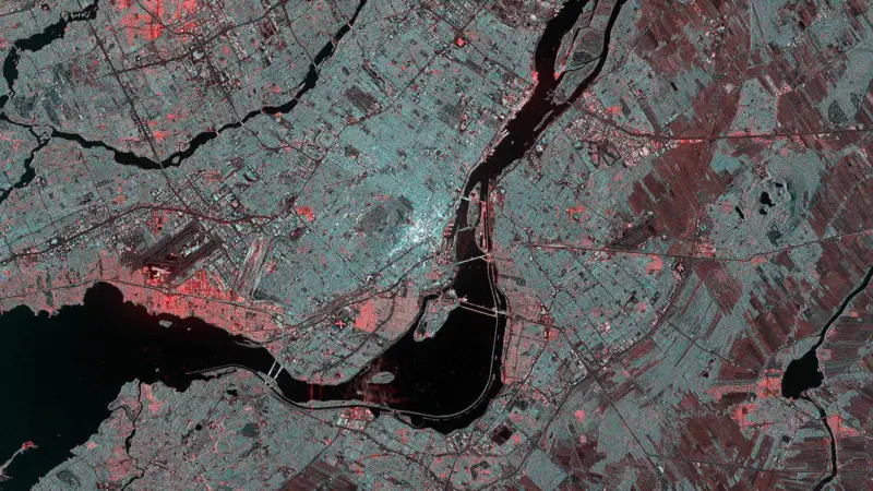
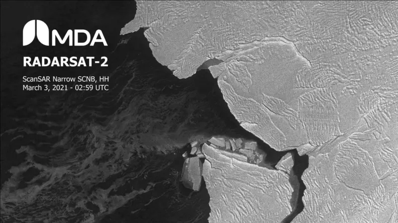
As the owner and operator of RADARSAT-2, a sophisticated, taskable, wide area commercial Synthetic Aperture Radar (SAR) satellite, we are one of the largest space-based radar information providers worldwide.
Our advanced Earth observation and defence intelligence systems see through all weather and cloud conditions – day or night. Our technology and analytics turn raw data into usable information and actionable insight in minutes, enabling governments and industries to monitor and respond to issues ranging from national security to climate change.
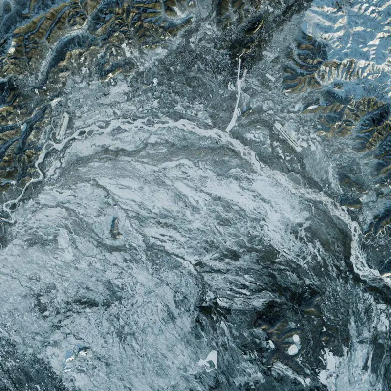
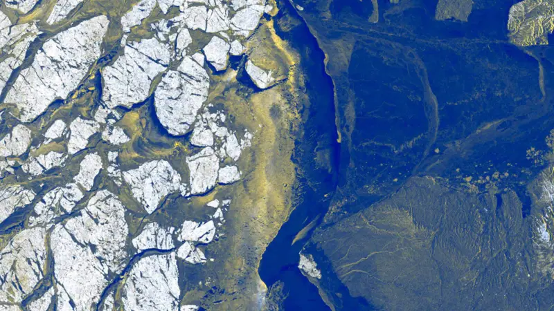
We do so by detecting change, identifying objects, classifying events, and examining trends. We can measure climate change and track ice floes, monitor crops for farmers, map wetlands for ecologists, detect pollution for environmental scientists, spot illegal deforestation and illegal fishing and keep an eye on military mobilization.
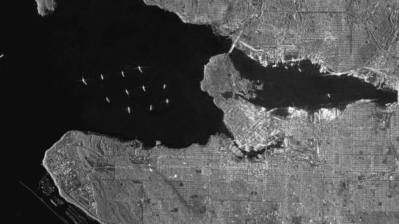
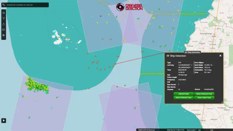
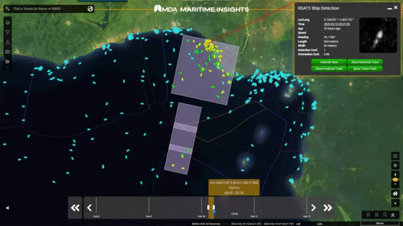
The largest market for our data and services is maritime surveillance. Government and commercial organizations rely on MDA for near real-time data to track maritime activity, visualize maritime crime patterns, track shorelines and ocean winds, detect oil spills, monitor vessels, and identify and monitor illegal, unreported, and unregulated (IUU) fishing. Our customers are global. MDA provides timely and critical information to the European Maritime Safety Agency (EMSA) to support maritime safety, law enforcement, border security, fisheries control, and marine pollution monitoring, including its CleanSeaNet program. MDA also supports the Canadian Department of National Defence on its Operation DRIFTNET program in support of Fisheries and Oceans Canada to protect wild fish stocks worldwide from the threat of IUU fishing. MDA’s imagery and analytics have also assisted in disaster clean-up efforts, including recent oil spills off the coasts of Venezuela, Nigeria and Iran, and are regularly used as part of the International Charter that sources satellite imagery for disaster response.
We also provide geospatial services that combine imagery, contextual information, analytics expertise, and innovative technology to deliver integrated intelligence solutions that document change and enable geospatial modeling and analysis to predict where events will occur.
Committed to continuous research, development, innovation and investment
We are currently developing CHORUS, a next-generation radar satellite constellation to enhance our Earth observation solutions and ensure that our RADARSAT-2 customers have data and information product continuity moving forward. CHORUS brings together diverse and unique imagery and data sources, changing how and when we see the world by leveraging artificial intelligence to manage large volumes of data and providing a new level of real-time insights and innovative earth observation services, including our cloud-based ground station solution.
As part of our Geointelligence business area, we provide a number of defence information solutions for customers. These include:
- Design and integration of the electronic warfare integrated product system including laser warning, radar sensor, jamming and communication subsystems for the Royal Canadian Navy’s new fleet of surface combatants
- Piloted and unpiloted control systems and airborne surveillance solutions
- Advanced aeronautical navigation information solutions that increase safety and efficiency of aircraft landings and departures, supporting the next generation of air traffic management